Development and Construction Aerial Photography in Toronto
A development site is photographed for different reasons than a house. The buyer is a lender, a planning committee, a leasing agent or a project marketer, and what they need to see is the whole parcel, its boundaries and what sits around it — the arterial road, the transit stop, the neighbouring blocks. None of that fits in a photograph taken from the ground. Photogenic Properties flies development, construction and commercial sites across Toronto and the Greater Toronto Area.
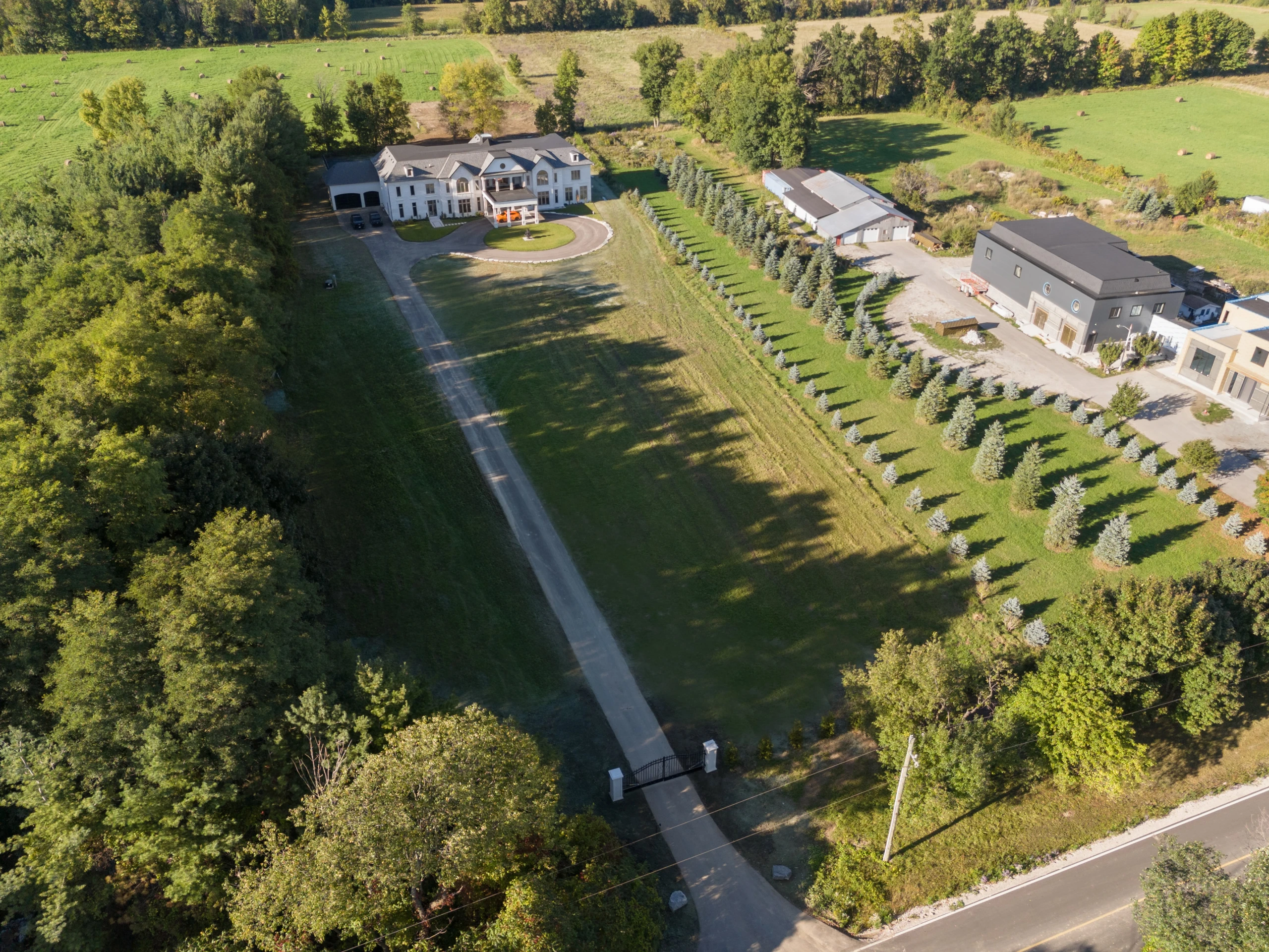
What an Aerial Shows That Ground Level Cannot
- The whole parcel in one frame. Boundaries, setbacks, the shape of the lot and how much of it is usable — the things a site plan describes and a photograph normally cannot.
- Context. What the site is next to: the highway, the rail corridor, the subway entrance, the retail strip, the residential edge. For a leasing or planning argument, the surroundings often matter more than the building.
- Access and circulation. Where trucks enter, where parking sits, how the loading area connects to the road.
- Scale. An industrial building photographed from the ground reads as a wall. From above it reads as a footprint, which is what a tenant is actually renting.
- Elevation and views. For a project still on paper, a flight at the height of a future floor shows the view that floor will have.
What It Is Used For
- Project launch and marketing. Aerials for the brochure, the project website and the sales centre, before there is a finished building to photograph.
- Leasing and sale of commercial sites. Industrial, retail and office parcels where the footprint, the parking and the road access are the selling points.
- Planning and consultation material. Context imagery for an application or a community presentation.
- Land assembly and vacant parcels. A site with nothing on it has no other photograph worth taking.
What a Flight Includes
Aerial photography and video is $199.99, and it is the one service on our price list that does not change with the size of the property — a small infill lot and a large industrial parcel cost the same. You receive a set of stills at several heights and angles, plus video, delivered by secure download link: photographs within 24 hours and video within 48.
If the finished building is what needs photographing rather than the site, that is architectural photography. For a house or condo listing, see drone photography for listings. For interiors of a completed commercial space, see commercial real estate photography. The full price list is on the packages page.
Progress Over the Build
A site can also be flown more than once, so the same angle exists at excavation, at frame and at completion — a sequence that is worth more to a lender or a project page than any single image. Our drone photography page has said for some time that we fly construction sites where progress is recorded over several visits; this is that work.
A single flight is $199.99. A programme of visits across a build is priced differently: it is quoted as one price for the whole project rather than per flight. Tell us roughly how many visits and over what period, and the project price comes back before anything is booked.
Airspace and Site Access
Two things decide whether a site can be flown, and both are worth settling before a date is booked. The first is airspace: much of Toronto and the inner GTA sits in controlled airspace around Pearson, Billy Bishop and Buttonville, where a flight needs authorization arranged in advance. The second is the site itself — an active construction site has its own access, timing and safety rules, and those are set by whoever runs it.
Send the address when you enquire and we will tell you what is possible before the shoot instead of on the day.
Who Flies It, and Under What Certificate
The flight is made by a pilot holding a Transport Canada Pilot Certificate — Basic Operations (RPAS), held since March 2022. On a planning submission, a leasing package or a launch that is usually the first question asked about the images, so it is stated here rather than on request.
What it means on a development site:
- The aircraft is registered with Transport Canada and marked with its registration number.
- Flights are planned for uncontrolled airspace, at least three nautical miles from a certified airport and one from a heliport, below 122 metres, and within visual line of sight.
- Thirty metres of horizontal separation is kept from anyone not part of the shoot, so on an active site the flight is planned around where the crews are working — and often around when they are not.
- A site inside the controlled airspace around Pearson, Billy Bishop or a regional airport is a separate case, settled from the address before a date is agreed.
Is your drone pilot certified for commercial work?
Yes. Development and construction flights are made under a Transport Canada Pilot Certificate for Basic Operations, held since March 2022, flown within visual line of sight and below 122 m. Send the site address with your enquiry and we will confirm what the airspace at that location allows before a date is agreed.
Development Aerial FAQ
Do you photograph sites that are still under construction?
Yes. A site with hoarding, cranes and bare ground still has to be shown to a lender, a planning committee or a prospective tenant, and an aerial frame is usually the only way to show the whole parcel and what surrounds it.
What does aerial coverage of a development site cost?
A single flight is $199.99, and it is the one service whose price does not change with the size of the property — a one-acre infill site and a twelve-acre parcel are charged the same. A programme of visits across a build is quoted as one price for the whole project rather than per flight.
Can you fly over a construction site in Toronto?
It depends on the address. Much of the city sits inside controlled airspace where a flight needs authorization arranged in advance, and an active site has its own access and safety rules. Send the address as early as you can and we will confirm what is possible before the shoot rather than on the day.
How quickly are the images delivered?
Photographs within 24 hours of the flight and video within 48 hours, by secure download link, the same as every other service.
Book an Aerial Shoot of Your Site
Send the site address and what the images are for — a launch, a leasing package, a planning submission — and we will confirm the flight and the airspace. Call (416) 894-9373 or order online. We cover Toronto and the Greater Toronto Area.
Next step
Send the address. We confirm everything before the shoot.
Published prices, one visit, 24-hour delivery. Call or order online and the full price is confirmed before you commit.